Following the Yellow line can lead to nowhere
Staying on the actual Route 66 is often a test of perseverance, luck, and a little imagination. Sometimes the Route 66 signs are spaced 10 miles apart or more, and with all the twists and turns, it’s easy to lose track of the original road.
One way to know you’re on the old route is by the concrete—back in the day, it was paved with concrete, but today it’s mostly asphalt.
 |
| No a sign in sight but it's concrete |
Some of the old Route 66 towns are still hanging on by a thread. And by "some," I mean a handful of die-hard souls, like in Texola, Oklahoma, where it feels like the stray dogs have taken over.
 |
| Downtown Texola |
Then there’s McLean, Texas, where a few people still hold down the fort, and the sense of humor hasn't disappeared yet.
Finding Jericho, Texas, though, was a bit of a scavenger hunt. It shows up on the maps, but that’s just the start.
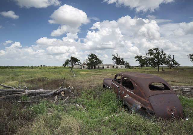
The Jericho I was looking for didn’t even show up on my GPS—turns out, the one that did show up was over 25 miles south of where I thought it would be. After some guesswork, I finally picked up a clue and headed down the road. The only sign I found with Jericho on it led me to a cemetery. Not exactly the thriving town I had envisioned. But hey, the road leading to the cemetery was a questionable dirt path, and I figured, why not? Adventure time. Sure enough, about 300 yards in, I found the remains of Jericho.
At least, what’s left of it. The last photos I had seen were taken back in 2011, and I had no idea it had deteriorated so much since then. I doubt what’s left will be standing much longer, but it was still fascinating.
One of the challenges in hunting down the last remnants of these towns is that many have been decommissioned over the years. They might still show up on a map, but all physical traces—like signs or landmarks—have long since disappeared. It’s like chasing ghosts, relying on old maps and a bit of intuition to find what’s left of these forgotten places.
 |
| Wonder is it's still under warranty |
Now, I’m in Amarillo, Texas. Back in the 1930s, this area was flooded with Dust Bowl migrants heading west with everything they owned strapped to their cars. Seems like not much has changed. Back then, they camped in shantytowns; today, they stop at places like Motel 6 and Motel 8. The scenery has changed, but the story seems to stay the same.
Tomorrow crossing into New Mexico.
More to come…


No comments:
Post a Comment